
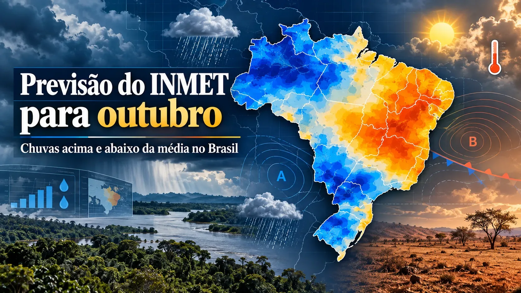
The October 2026 climate outlook from Brazil's National Institute of Meteorology (INMET) shows a country divided between areas with a signal for rainfall above and below the historical average. The clearest wet signal is in the South, parts of Mato Grosso do Sul and São Paulo, while below-average rainfall is indicated for sectors of the North, most of the Northeast and much of the Center-West. INMET presents these data as a monthly climate outlook based on departures from climatology, not as a daily forecast that can determine the exact day rain will occur in each city.
Where rainfall may be above or below average in October
INMET's monthly map represents precipitation anomalies. In practical terms, it compares the rainfall projected for October with what is climatologically expected for the month. Blue indicates a tendency toward above-average totals; yellow and orange indicate a tendency toward below-average totals. The map should be read regionally because the bulletin also highlights irregular rainfall distribution in some states.
| Region or sub-region | Rainfall signal for October 2026 | Detail from the INMET outlook |
|---|---|---|
| North | Mostly below average | Deficits are highlighted across much of Roraima, northern Amazonas and southeastern and southwestern Pará. Southwestern Amazonas, the Acre Valley and Amapá may be near or above average. |
| Northeast | Mostly below average | Rio Grande do Norte and parts of Ceará, Piauí, Paraíba and Bahia may stay near climatology. From eastern Sergipe to northeastern Bahia, as well as southern Bahia, the bulletin indicates rainfall deficits. |
| Center-West | Mostly below average | Mato Grosso, Goiás, the Federal District and parts of Mato Grosso do Sul, especially the Pantanal and the north-central part of the state, concentrate the negative signal. Southwestern and eastern Mato Grosso do Sul are expected to have above-average totals. |
| Southeast | Irregular scenario | Minas Gerais and Espírito Santo tend to stay below average. São Paulo has a signal for more substantial rainfall, especially between Itapetininga and the southern coast. Rio de Janeiro is expected to be near average, although rainfall distribution may be irregular. |
| South | Above average | INMET indicates positive anomalies of about 75 mm. In eastern Rio Grande do Sul, rainfall may exceed the climatological average by as much as 200 mm. |
What the outlook indicates for temperatures
In addition to rainfall, INMET forecasts above-average temperatures across much of Brazil in October. The largest departures are expected mainly in the Center-West and Southeast. In the North, positive anomalies of 1.5 °C to 2.0 °C are indicated in the warmest areas, especially central Pará and Acre. In the Northeast, much of MATOPIBA may reach 1.5 °C above average, while central Bahia may reach 2 °C above average.
In the Center-West, the outlook points to mean temperatures more than 2 °C above climatology in parts of central Goiás, including the Federal District, and in far northwestern Mato Grosso do Sul. In the Southeast, Minas Gerais may exceed a positive anomaly of 2 °C, while northern São Paulo may reach 2 °C above average. In the South, the projected departures are smaller: up to 1.5 °C in Paraná and generally up to 1 °C in Santa Catarina and Rio Grande do Sul, with parts of Rio Grande do Sul closer to average.
A monthly climate outlook is not a daily forecast
The key to interpreting the bulletin is to separate the monthly scale from the daily scale. The October climate outlook describes the expected behavior of the month as a whole and anomalies relative to climatology. It does not mean that a city will have rain every day within a blue area, nor that it will remain rain-free throughout the month within a yellow or orange area.
A region can finish October above average even after many dry days if a few rainfall events are sufficiently intense. Likewise, an area with a below-average monthly signal can still experience thunderstorms or rainy days and end the month with a total below normal. The seasonal map is therefore useful for trend and context, but it does not replace short-range weather forecasts.
How to use the INMET map without drawing the wrong conclusion
- Read the signal as a monthly tendency: above or below average does not mean continuous rain or a total absence of rain.
- Look for exceptions within each region: the bulletin identifies sub-regions that differ from the broader regional pattern, including parts of Mato Grosso do Sul, São Paulo, Acre and Amapá.
- Account for irregularity: in the Southeast, for example, INMET explicitly notes irregular distribution, so the entire region should not be treated as homogeneous.
- Recheck short-range forecasts: for travel, outdoor activities, alerts or rainfall on a specific date in a specific city, consult forecasts and warnings closer to the date.
- Interpret anomaly values in context: the up to 200 mm above average mentioned for eastern Rio Grande do Sul is a departure from climatology, not the absolute monthly rainfall total.
When to check again
Because the outlook was published on September 25, 2026, it represents the projected scenario before October began. Climate models can change as new observations enter forecasting systems. During the month, the safest approach is to combine the climate bulletin with INMET's updated weather products, especially when the decision depends on a specific date, municipality or event.
In summary, the clearest October 2026 signal is for above-average rainfall in the South and in parts of south-central Brazil, particularly portions of Rio Grande do Sul, Mato Grosso do Sul and São Paulo. The North, Northeast and much of the Center-West show a stronger presence of negative rainfall anomalies. At the same time, above-average temperatures are expected across much of Brazil, particularly in the Center-West and Southeast.